By The Rio Times | Created at 2026-08-13 17:36:43 | Updated at 2026-08-13 18:45:41
1 hour ago
By The Rio Times | Created at 2026-08-13 17:36:43 | Updated at 2026-08-13 18:45:41
1 hour ago
Colombia · Travel
Key Facts
- —About 13 roads hit Invias counted roughly 13 national corridors closed or restricted just after the quake, and at least nine named routes were still affected on 13 August 2026.
- —Fully closed Cartago-Alcala, Armenia-Alcala, Pereira-Chinchina and Cali-Loboguerrero were reported shut by landslides, along with the Alto de Letras section toward Fresno.
- —Down to one lane Calarca-Cajamarca is passing traffic on a single lane at three points, and the Libertad-Fresno bridge route has about four affected kilometres.
- —Reopened the Cauya-La Felisa section has been fully cleared and put back into service.
- —It changes hourly check Invias and the police road pages before you leave, because openings and closures shift through the day.
The map is redrawing itself by the hour across the coffee belt. Before you drive to Pereira, Armenia or Manizales, know what is shut, one-laned, or reopened.
One-stop reference
Company Intelligence
Every listed company in Latin America — financials, ownership and structure for 1,450+ companies across 26 exchanges, in one place.
The Colombia road closures from the 10 August 2026 earthquake could reshape any drive across the coffee region. Invias counted about 13 national roads hit right after the quake.
And by 13 August 2026 many were still cut, one-laned, or only just reopening.
Why the Colombia Road Closures Matter for Your Drive
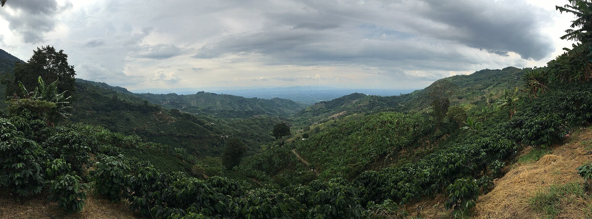
The coffee region sits in steep, wet mountains, and its main roads thread along valley walls and high passes. When the ground shakes, those slopes give way and the road underneath simply disappears.
That is what the 10 August 2026 earthquake did to more than a dozen corridors at once. Landslides, called derrumbes locally, buried lanes, cracked bridges and cut whole towns off from the main highways.
For a driver, that means a route you took last month may not exist today. This guide walks through which roads are shut, which are squeezed to one lane, and which have reopened.
How Many Roads Are Actually Affected
Invias, the national roads agency, counted about 13 corridors closed or restricted in the first reports after the quake. That figure is a snapshot, not a fixed number, and it has moved as crews clear debris.
As of 13 August 2026, at least nine named routes across the coffee belt and Valle del Cauca were still affected. Some have since reopened, and others may close again if the slopes keep slipping.
So treat any single count as rough. The useful thing is not the total but knowing the status of the exact road you plan to use.
The Routes That Are Fully Closed
Several corridors were reported completely shut by landslides. They include Cartago-Alcala, Armenia-Alcala, Pereira-Chinchina and Cali-Loboguerrero.
The Pereira-Chinchina closure sat between roughly kilometre 22 and 24, blocked by a slide. On the Manizales-Fresno road, the Alto de Letras pass was closed at the Cerro Bravo section.
A full closure means there is no way through, not a slow crawl. If your route touches one of these, you need a different road entirely, not patience.
Calarca-Cajamarca: One Lane, Three Pinch Points
The Calarca-Cajamarca corridor is the busy crossing over the central mountains near the La Linea tunnel. It stayed open, but only barely.
Crews have it passing traffic on a single lane at three separate points. That means stop-and-go control, long waits, and convoys let through one direction at a time.
You can still use it, but budget far more time than usual. Expect to sit in line while flaggers alternate the traffic through each narrow stretch.
The Libertad-Fresno Bridge Route
Over in Tolima and Caldas, the Libertad-Fresno bridge route took a string of hits. Reports describe about four affected kilometres, with several damaged points along the corridor.
Much of that stretch is moving on a single lane where it is open at all. The damage clusters around the bridge and the approaches on either side.
If you are heading between Manizales, Fresno and the Magdalena valley, this is the corridor to check first. Its status has been among the most changeable since the quake.
Cartago-Alcala and the Valle Crossings
Cartago-Alcala, linking Valle del Cauca and Quindio, was reported closed by earth movement. It is one of the clearer full closures on the list.
Nearby, Santa Cecilia-Asia in Risaralda was also flagged by Invias among the affected corridors. Reports differ on whether it is fully shut or held to one managed lane, so treat it as blocked until you confirm.
Other Valle crossings, including Cali-Loboguerrero and stretches of the Buga-Buenaventura road, were hit as well. If your trip runs west toward the Pacific, check each leg separately.
The One Piece of Good News: Cauya-La Felisa Reopened
Not everything is bad news for drivers. The Cauya-La Felisa section, closed by a slide right after the quake, has been fully cleared.
Invias reported it back in service, carrying traffic again. It is a reminder that these closures are being worked around the clock, and some do lift within days.
That is also the catch. A road open this morning can shut again by evening if the hillside above it moves.
So a reopening is good news, not a guarantee.
How to Check the Status Before You Leave
The single most useful habit right now is to check the official status the morning you travel. Invias runs a live road-status page, and the national police publish one too.
Invias posts updates on its site and its social channels, often by exact route name and kilometre. The police estado de las vias page is a good second source to cross-check.
Ask locally as well, because drivers and bus operators often know a slide before the page updates. A quick call to a hotel or a bus terminal can save you a wasted trip.
Planning a Detour
When your usual road is shut, the detour is often long, because the mountains leave few alternatives. Crossing the central range, for instance, funnels almost everyone onto the same few passes.
If Calarca-Cajamarca is crawling, some drivers wait it out rather than attempt a much longer loop. If Cartago-Alcala is closed, plan a wider route through the open Valle del Cauca roads.
Fuel up before you set off and carry water and snacks. A one-lane pass or a surprise closure can turn a two-hour drive into most of a day.
What to Expect on the Road Right Now
Even on open roads, expect slower going across the whole region for a while. Crews, machinery and loose material are common, and speed limits drop through work zones.
Drive for the conditions, not the map. Rain loosens already-fragile slopes, so mornings after a wet night are when fresh slides are most likely.
Above all, do not squeeze past barriers or drive around a closure sign. Those closures mark ground that is still moving, and the risk is real.
Frequently Asked Questions
Which roads are closed?
Corridors reported fully closed include Cartago-Alcala, Armenia-Alcala, Pereira-Chinchina and Cali-Loboguerrero. Closures shift daily, so confirm on Invias before you travel.
Can I still drive Calarca-Cajamarca?
Yes, it stayed open, but it is passing traffic on a single lane at three points. Expect long waits and stop-and-go control, and allow far more time than usual.
How do I check current status?
Use the Invias live road-status page and its official social channels, and cross-check the national police estado de las vias page. Ask locally too, since drivers often know about a slide before the pages update.
Is there a detour?
Usually yes, but the mountains make detours long, and sometimes waiting out a one-lane stretch beats a wide loop. Plan the alternative before you leave, fuel up, and carry water in case the drive stretches out.
Sources: Invias (Instituto Nacional de Vias) road-status reports; Policia Nacional estado de las vias; Semana, La FM and regional Colombian media, 10-13 August 2026.