By The Straits Times | Created at 2026-06-10 21:06:52 | Updated at 2026-06-11 05:26:19
8 hours ago
By The Straits Times | Created at 2026-06-10 21:06:52 | Updated at 2026-06-11 05:26:19
8 hours ago
JOHOR BAHRU – The Malaysian Transport Ministry and the Johor state government have spent millions over the past few years ramping up the state’s public transport network.
Despite that, limited routes, low frequencies and the lack of bus stop markings continue to pose a challenge for commuters in Johor Bahru.
For Singaporeans who prefer to take public buses to get around the state capital, here are some tips to make the journey smoother.
There are two main operators: BAS.MY and Bas Muafakat Johor. Here is how to tell them apart:
Operates 21 routes with 162 buses
Buses are painted pink
Carries the “J” prefix on its services
Routes are mainly concentrated in JB
Operates 65 routes with 79 buses
Buses are clad in either red or white livery
Carries the “P” prefix on its services.
Serves 10 routes in JB, and also serves feeder routes in far-flung districts including Mersing, Kluang, Segamat, Batu Pahat and Muar
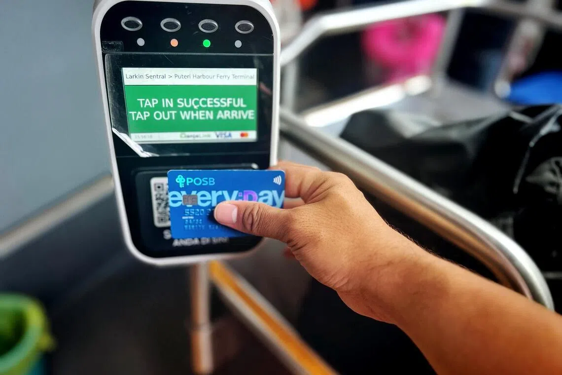
BAS.MY services accept cash, Malaysian e-wallet digital payments via QR codes, the ManjaLink stored-value card, and most Visa and Mastercard bank cards as well as mobile payments.
Bas Muafakat Johor is free for Malaysians with a valid MyKad identification card or the Kad Muafakat Johor. Foreigners, however, must purchase a digital Foreign Tourist pass via the My Johor Transport (MYJT) app. A 14-day pass costs RM20 ($6.33).
BAS.MY services accept cash, Malaysian e-wallet digital payments via QR codes, the ManjaLink stored-value card, and most Visa and Mastercard bank cards as well as mobile payments.
ST PHOTO: HARITH MUSTAFFA
J10: JB Sentral Kota Tinggi (serves Tebrau area, including AEON Mall Tebrau City and Toppen Shopping Centre)
J16: B5 Johor Street Market – Larkin Sentral – Toppen Tebrau
P106: PPR Sri Stulang – AEON Mall Tebrau City
P111: Desa Mutiara – AEON Mall Tebrau City (via Mount Austin and Setia Indah)
J15: JB Sentral – Mid Valley Southkey
P103: Larkin Sentral – Mid Valley Southkey
J34: JB Sentral – Sutera Mall
J13: JB Sentral – Larkin Sentral
P101: Larkin Sentral – JB Sentral (city-centre loop)
J33: JB Sentral – Taman Tan Sri Yaacob (stops at AEON Mall Bukit Indah)
J44: Larkin Sentral – Puteri Harbour Ferry Terminal via AEON Mall Bukit Indah
J10: JB Sentral – Kota Tinggi
J50: Larkin Sentral – Terminal Pontian
While some bus stops have no clear physical markings, their locations can be found on Google Maps. You may use Google Maps to track your location and know when to alert the bus driver to stop.
The LUGO app is the authorised application that allows users to digitally plan their routes on BAS.MY services, track arrival times and monitor the number of stops required to reach their destination.
Users have found it to be accurate during low traffic conditions, but timing estimates may vary when there is congestion.
Apart from traffic monitoring, the app can be used to top up the ManjaLink stored-value card.
The app gives commuters access to real-time departure and journey planning features on Bas Muafakat Johor services, BAS.MY services, local shuttle buses, ferries and intercity rail services.
Sign up for our weekly Asian Insider Malaysia Edition newsletter to make sense of the big stories in Malaysia.
Harith Mustaffa is a journalist covering Malaysia for The Straits Times, with a focus on Johor.