By The Rio Times | Created at 2026-09-28 10:35:05 | Updated at 2026-09-28 12:38:32
4 hours ago
By The Rio Times | Created at 2026-09-28 10:35:05 | Updated at 2026-09-28 12:38:32
4 hours ago
MEXICO · WEATHER & SAFETY
Latest — September 28, 2026, 2 a.m. local time (NHC advisory 31)
— Landfall today: Polo is expected to move inland along the coast of Baja California Sur late this afternoon or early this evening near major-hurricane strength, then reach southern Sonora late tonight or early Tuesday still a hurricane. Conditions begin deteriorating this morning.
Free daily brief — no card needed
Get every Expats & Nomads story in one morning email
We build you a personalized brief around the topics you follow — free for 7 days. Love it? Your first month after that is US$1.
Yes, email me my free daily brief — I can unsubscribe any time.
— Current strength: 115 mph (185 km/h), category 3, 958 mb, centred 23.6N 113.8W — 125 mi south-west of Cabo San Lazaro, moving north-north-east at 10 mph ahead of a turn to the north-east this afternoon.
— Rainfall upgraded: Baja California Sur now faces 6–12 inches (up from 4–8); Sonora 4–6 in (max 8). Life-threatening flooding and mudslides possible, especially in steep terrain. New Hurricane Warning on the east coast of BCS from Loreto to Bahia San Juan Bautista.
— Next intermediate NHC advisory at 5 a.m. MST (12:00 UTC), next complete advisory at 8 a.m. MST (15:00 UTC).
Source: NHC advisory 31
Key Facts
- —The country Mexico’s Pacific corridor runs from Acapulco through Manzanillo and Puerto Vallarta to Los Cabos. It is a resort coast with a large foreign resident and visitor population.
- —The system Mexican states answer an approaching storm with colour-coded alerts, school closures, port restrictions and shelters. Puerto Vallarta currently sits on blue alert, the lowest level.
- —What changed Hurricane Polo reached Category 5 and then almost stopped moving, drifting northeast at 1 mph. Central pressure fell to 905 millibars from 920 earlier in the day.
- —What happened In its 9 p.m. advisory on Tuesday 22 September 2026, the US National Hurricane Center placed Polo about 210 miles (335 km) south of Zihuatanejo, with winds of 165 mph (270 km/h).
- —What is shut Acapulco’s port closed to small boats on Monday afternoon. Guerrero suspended classes on Tuesday, Michoacán closed schools in seven coastal municipalities, and Jalisco readied 38 shelters for about 10,000 people.
- —What it means for you A tropical storm warning runs from Tecpan de Galeana to Punta San Telmo. Expect 3 to 6 inches of rain in Guerrero and Michoacán, plus mudslides and dangerous surf.
- —Still open The track. Forecasters expect a sharp turn to the northwest that keeps the core offshore, and give Manzanillo a 5 percent chance of tropical-storm winds, Cabo San Lucas 1 percent.
Update — Monday 28 September 2026, early morning (NHC intermediate advisory 30A)
Polo is now a Category 3 hurricane with 120 mph (195 km/h) sustained winds and a central pressure of 954 mb, about 260 miles (420 km) west of Cabo San Lucas, moving north at 10 mph (17 km/h) with a turn to the northeast expected today.
Overnight, Mexico upgraded the mainland watch to a hurricane warning: warnings now cover the Baja California Sur west coast from Punta Abreojos to Santa Fe, the east coast from Loreto to Santa Rosalia, and the mainland from Bahía Kino to Huatabampito. Hurricane conditions reach the peninsula’s west coast by late this afternoon; the center crosses the peninsula this evening and nears the mainland coast late tonight or early Tuesday, still as a hurricane. Rainfall of 4 to 8 inches (locally up to 12) is forecast in Baja California Sur, and 4 to 6 inches (up to 8) in Sonora.
Full coverage in today’s LatAm Expat & Nomad Daily Guide.
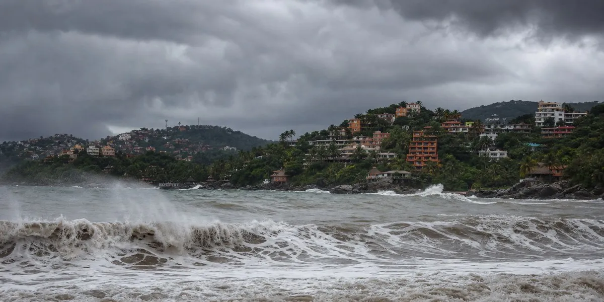
A Category 5 hurricane sitting nearly still off the Pacific coast sounds worse than it currently is for most travelers — and worse than it sounds for the stretch of Guerrero and Michoacán directly under the warning. Here is what is actually closed, what is actually at risk, and how to read the next 72 hours if you live on or are visiting Mexico’s Pacific corridor.
One-stop reference
Company Intelligence
Every listed company in Latin America — financials, ownership and structure for 1,450+ companies across 26 exchanges, in one place.
Where Polo Is and Where It Is Going
At 9 p.m. CST on Tuesday 22 September, the National Hurricane Center put Polo’s center about 210 miles (335 km) south of Zihuatanejo, with maximum sustained winds of 165 mph (270 km/h) and a central pressure of 905 millibars — down from 920 millibars earlier in the day, a sign the storm was still organizing. Polo is barely moving, drifting northeast at 1 mph, and forecasters expect a sharp turn to the northwest that would keep the core offshore while tracking roughly parallel to the coast through midweek.
President Claudia Sheinbaum said Tuesday the hurricane “will not reach the coast directly”. The NHC’s own language is more conditional — the core is forecast to remain near the southwestern coast — which is why the tropical storm warning exists at all: tropical-storm-force winds extend up to 105 miles from the center, and a small shift in the track changes which towns feel them.
What Is Closed and What Is Open
The practical shutdowns so far are maritime and educational. Acapulco’s port closed to small boats on Monday at 3 p.m. Guerrero suspended classes on Tuesday across the Costa Grande, Acapulco and Costa Chica regions. Michoacán closed schools for Tuesday and Wednesday in seven coastal municipalities and opened 19 shelters. Jalisco has 38 shelters ready for about 10,000 people, and the army’s DN-III-E disaster plan is on preventive deployment in Guerrero, Jalisco and Colima, with the navy’s Plan Marina active alongside.
Puerto Vallarta is on blue alert, the lowest of Mexico’s five alert levels, and outside the warning area. The visible effect there so far is one cruise ship: the Island Princess moved its Puerto Vallarta call from Wednesday to Thursday. Airports along the corridor — Acapulco, Ixtapa-Zihuatanejo, Manzanillo, Puerto Vallarta — were operating as of Tuesday night; airlines have not announced blanket cancellations, but that can change with each advisory.
The Rain Is the Real Risk for Most People
For anyone not on a boat, Polo’s danger is water, not wind. The NHC forecasts 3 to 6 inches of rain, with isolated amounts of 8 inches, in Guerrero and Michoacán, and 2 to 4 inches in Oaxaca, Colima and Jalisco through Thursday — enough for flash flooding and mudslides in the Sierra Madre del Sur foothills, where September has already saturated the ground. Dangerous surf and coastal flooding are expected along the warning area. If your plans involve the Costalegre, the Michoacán coast or Highway 200, the road — not the resort — is the thing to recheck before each leg.
Puerto Vallarta, Manzanillo and Los Cabos
Three places travelers ask about, three different answers. Manzanillo sits inside the watch area’s logic: the NHC’s latest table gives it a 5 percent chance of tropical-storm winds; Lázaro Cárdenas, at 8 percent, is the highest listed. Puerto Vallarta faces rough seas and schedule shuffles rather than a direct threat this week. Los Cabos is a weekend question: the moisture plume trailing Polo could reach the southern Baja peninsula by early Sunday 27 September, with the NHC assigning Cabo San Lucas a 1 percent and San José del Cabo a below-1-percent chance of tropical-storm winds through early Sunday, rising to about 7 and 5 percent by early Monday — low odds, but the first reason Baja travelers have had to look at this storm.
What to Watch and When
The NHC issues full advisories at 3 a.m. and 9 a.m. CST, with intermediate updates between them; Wednesday’s 3 a.m. advisory is the next scheduled checkpoint. The details that matter for decisions: any westward shift of the forecast cone toward Manzanillo or Puerto Vallarta, any upgrade of the watch west of Punta San Telmo, and the rainfall totals once bands start training onshore. For the broader regional picture — including how Polo interacts with this week’s flights, ports and prices — see our daily guide for Wednesday 23 September.
Should I cancel a flight to Acapulco, Zihuatanejo or Puerto Vallarta this week?
Not automatically. Airports on the corridor were operating normally as of Tuesday night, and the hurricane’s core is forecast to stay offshore. The cases for rebooking are specific: you are connecting by road along Highway 200, you have boat or beach activities in Guerrero or Michoacán through Thursday, or your accommodation sits in a flood-prone area. Otherwise, recheck your flight status against each NHC advisory — 3 a.m. and 9 a.m. CST — and let the airline’s waiver policy, not the headline category, drive the decision.
I live on the coast in Guerrero or Michoacán. Should I evacuate?
Follow your municipality, not the internet. The ordered measures so far are school suspensions, port closures to small boats and shelters on standby — 19 in Michoacán’s seven coastal municipalities, 38 across Jalisco — not general evacuations. If local authorities open a shelter in your municipality or your home is in a known flood or landslide zone, move early, while roads are dry. Keep documents, medication and a charged phone in one bag regardless.
What does Category 5 offshore actually mean for people on land?
Less than the label suggests, if the forecast holds — and that “if” is doing the work. Category 5 describes winds at the core, 210 miles offshore at last advisory; what reaches land is tropical-storm-force wind at the edges, heavy rain and surf. That is why the NHC’s rainfall forecast — 3 to 6 inches, isolated 8, in Guerrero and Michoacán — matters more to most residents than the 165 mph figure. Treat the category as a reason to check twice daily, not as a description of what will hit your street.
Sources
- National Hurricane Center — Hurricane Polo Advisory No. 10, 9 p.m. CST 22 September 2026 (position, intensity, warnings, rainfall and wind probabilities)
- Government of Mexico / state governments of Guerrero, Michoacán and Jalisco — port closure, school suspensions and shelter counts, via The Rio Times desk, 21–22 September 2026
- President Claudia Sheinbaum, morning press conference — “will not reach the coast directly”, 22 September 2026
- Princess Cruises itinerary change — Island Princess Puerto Vallarta call moved 23 to 24 September, via The Rio Times desk
- The Rio Times desk reporting, 21–23 September 2026
More: Mexico news in English, every day from The Rio Times. See also our daily guide for Wednesday 23 September.