By The Independent (World News) | Created at 2024-09-30 15:10:20 | Updated at 2024-09-30 21:32:22
6 hours ago
By The Independent (World News) | Created at 2024-09-30 15:10:20 | Updated at 2024-09-30 21:32:22
6 hours ago

The best of Voices delivered to your inbox every week - from controversial columns to expert analysis
Sign up for our free weekly Voices newsletter for expert opinion and columns
Sign up to our free weekly Voices newsletter
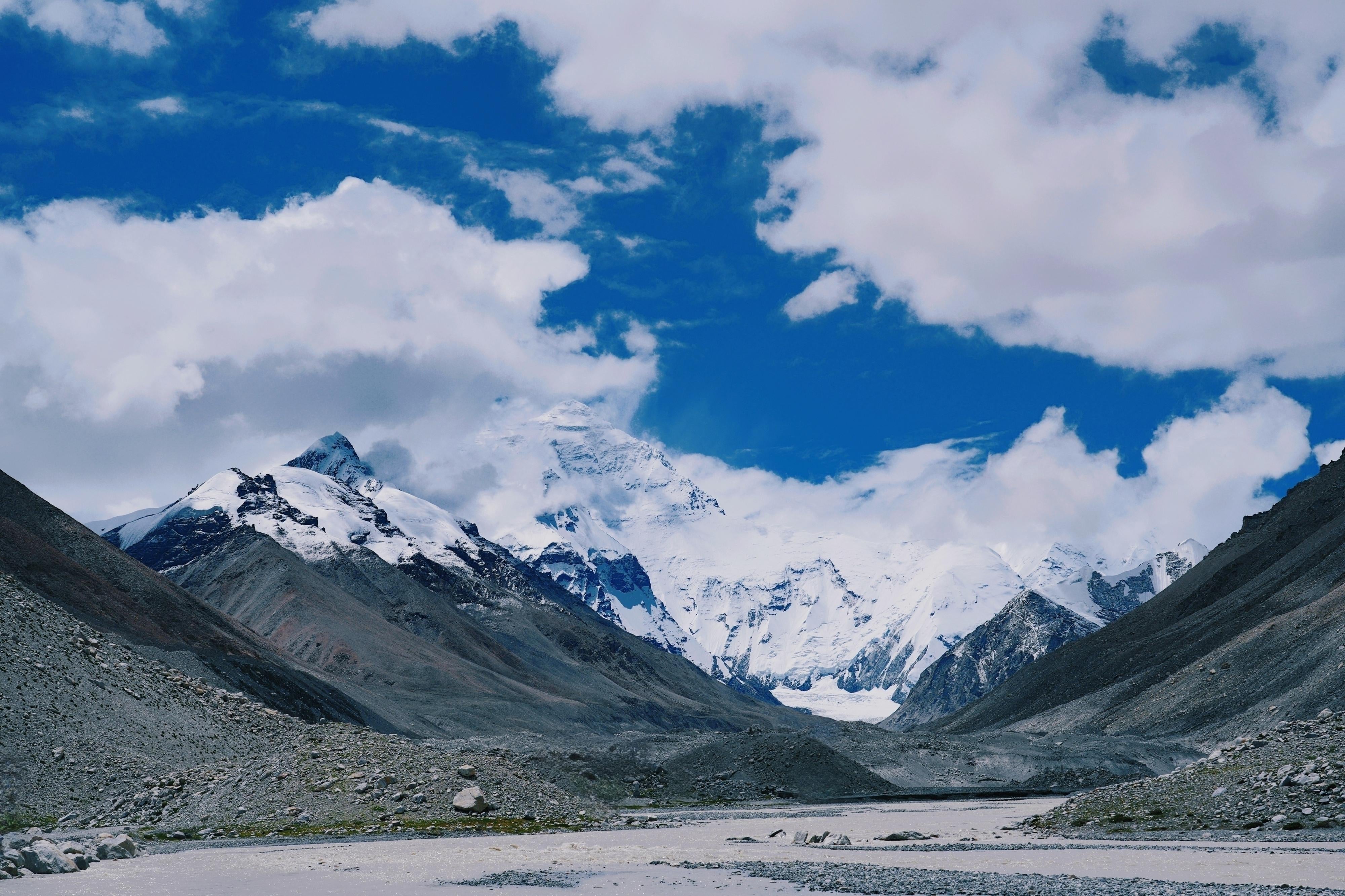
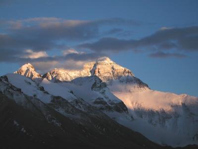
Scientists may finally have an explanation for why Mount Everest is so much taller than the other great Himalayan peaks – and still growing.
Everest is known to be growing by about 2mm a year, and the official figure for its height was last revised upwards by almost a metre in 2020 to 8,848.86m.
The mountain’s growth was previously put down to the shifting of tectonic plates, though this theory did not explain why Everest’s peak is abnormally high compared to others in the range, towering about 250m above the next-tallest peak in the Himalayas. The next three of the world’s tallest peaks – K2, Kangchenjunga, and Lhotse – only differ from each other in height by about 120 metres.
Now researchers from University College London (UCL) have found that erosion from a river network about 75km (47 miles) away from the world’s highest mountain may be contributing to Everest’s growth, as the river carves away a substantial gorge.
This erosion is creating a seemingly paradoxical phenomenon called uplift, which happens when a section of the Earth’s crust loses mass and then “floats” upwards due to intense pressure from the hot liquid mantle below.
The process is not fast, with scientists estimating that Everest has grown by between 15 and 50 metres in the past 89,000 years. But it is still measurable with modern technology, according to the study published on Monday in the journal Nature Geoscience.
“We can see them growing by about 2mm a year using GPS instruments, and now we have a better understanding of what’s driving it,” said Matthew Fox, a co-author of the study from UCL.
While this gradual process leads to only a few millimetres of growth each year, over geological timeframes it can make a significant difference.
In Everest’s case, this process appears to have sped up over the last 89,000 years since the nearby Arun River merged with the adjacent Kosi.
The merging of the two rivers led to more water funnelling through the Kosi River and increasing its erosive power, scientists say. As more land started getting washed away, it gradually triggered an increased rate of uplift for Everest, pushing the mountain’s peaks further up.
“Our research shows that as the nearby river system cuts deeper, the loss of material is causing the mountain to spring further upwards,” study co-author Adam Smith from UCL said.
The Arun River currently runs to the east of Mount Everest, and merges downstream with the larger Kosi river system. Over thousands of years, it has carved out a gorge that has washed away billions of tonnes of earth and sediment.
“The upstream Arun River flows east at high altitude with a flat valley. It then abruptly turns south, dropping in elevation and becoming steeper,” Jin-Gen Dai, another author of the study, said.
“This unique topography, indicative of an unsteady state, likely relates to Everest’s extreme height,” Dr Dai said.
The phenomenon is also affecting the neighbouring peaks of Lhotse and Makalu – the world’s fourth- and fifth-highest peaks – scientists say.