A summer weather feature more typical of a July heatwave is about to throw the end of December into Christmas chaos.
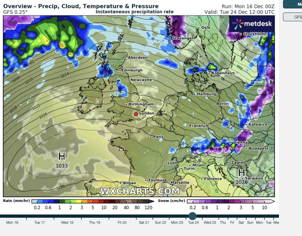
Creeping up from the tropics, the Azores High – a huge region of high pressure that drives summer heatwaves – has set up camp off the southwest coast.
It will clash swords with low pressure pushing from the north, throwing the Christmas outlook into a teetering balance.
Weather experts predict a hectic mix of storms, freakishly warm temperatures and possibly a hint of Christmas snow.

Jim Dale, meteorologist for British Weather Services, said: “The Azores High is sitting down to the southwest of the country and where it ends up is going to make the difference between a mild Christmas or a cold Christmas, and at the moment, it looks like that demarcation point will be around Scotland and northern England.
“As the Azores High pushes into the west, there might be a bit of wind over the next week or so, with temperatures around average.
“Then, as we get closer to Christmas, as that high pushes upwards, we are looking at milder temperatures which, depending on how far it goes, could reach as far as Scotland.”
Britons hoping to wake on December 25 to a Dickensian Christmas snow globe are likely to be disappointed.
Once again, hopes of a White Christmas have all but vanished, with milder conditions for most almost certain.
LATEST DEVELOPMENTS:
An official White Christmas requires one flake of snow to fall anywhere in the country, most likely now over the Scottish mountains.
Dale said: “The cold weather is now to the east, over Eastern Europe and they will see the snow this year.
“For us, a White Christmas is very unlikely, although there might be a bit of snow around further north during the next week.”
Britain’s weather will this week, follow the same autumn pattern of a cold snap followed by wind and rain.
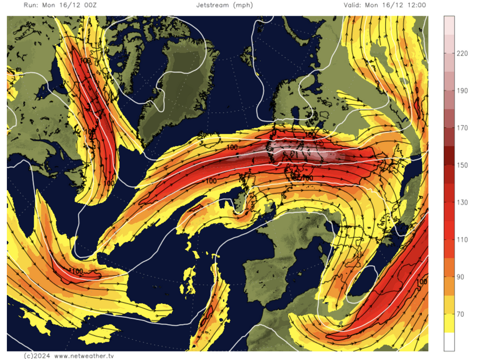
An unusually positioned jet stream will fuel the ongoing clash between high and low pressure driving the weird pendulum effect.
The jet, a fast-flowing ribbon of air high in the atmosphere, is usually further south at this time of year.
Jet stream sits right over the UK
Netweather
Over the past months, however, it has been wedged almost directly over the UK, opening the gates to storms from the Atlantic before it loops south to let in the cold.
The next few days look no different, with an icy start to the week to give way to a milder but more unsettled weekend.
Met Office meteorologist Honor Criswick said: “We have a large amplification of the pattern and a large upper trough that is driving a ridge out into the Atlantic and this is being driven by some quite cold air over eastern parts of Canada.
“As we move into the start of the week, that’s when we see that milder air creep in, but with milder air we get lots of cloud and moisture, particularly in western areas.
“We will see a slight creep up of temperatures with highs of 10C or 11C, so it’s not going to feel quite as chilly.”
A Met Office spokesman added: “Outbreaks of rain will develop across many northern and western areas, heavy in places, and becoming increasingly windy.
“On Wednesday, overnight rain will clear to brighter weather with blustery showers.
“Further rain will affect the south later, clearing Thursday morning. It will turn colder, with sunshine and showers later this week.”

 By GB News (World News) | Created at 2024-12-17 08:36:23 | Updated at 2024-12-17 10:34:14
2 hours ago


