America is facing a ‘rare and significant’ winter weather event with ‘back-to-back’ storms to plough the nation with a ‘corridor of snow’.
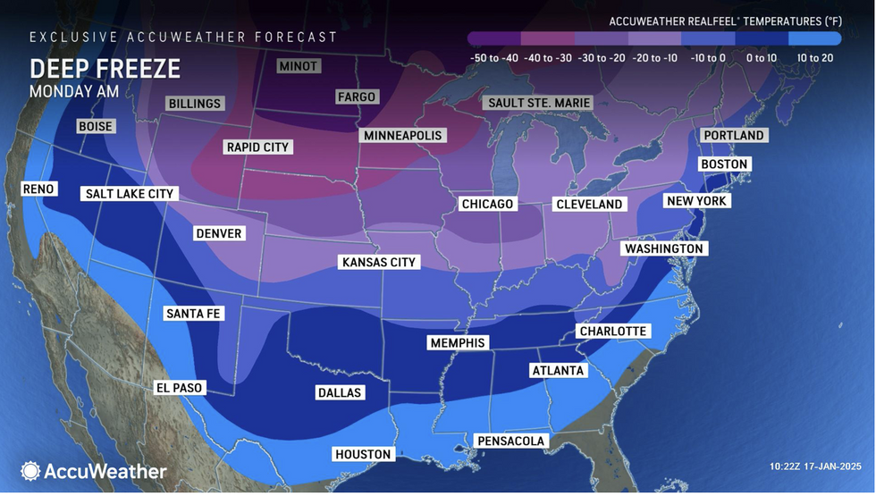
A ‘dangerous freeze’ sparking rafts of cold weather warnings threaten the coldest temperatures for a year at the end.
Eastern states are first in the firing line for the assault this week with a vicious ‘Nor’easter’ to hit New England, New York, Philadelphia and Washington DC.
The storm, named for its unusually strong north-easterly winds, will open the doors to a barrage of assaults.
AccuWeather map shows windstorm to hit US
AccuWeather
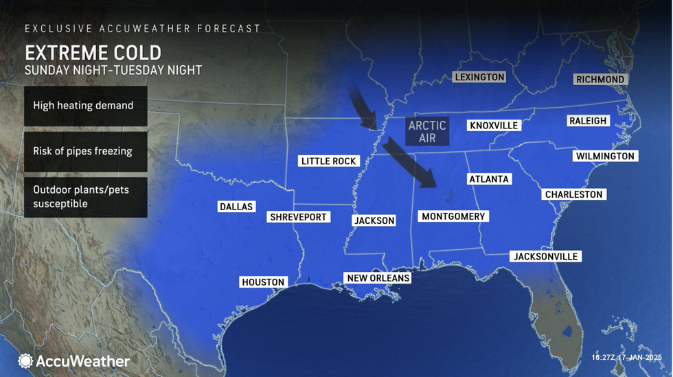
DaSilva said: “Dangerously cold Arctic air will lead to a surge in demand for heating and electricity across much of the eastern and central United States.
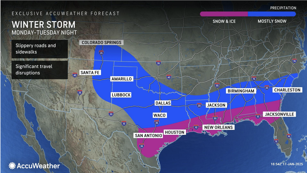
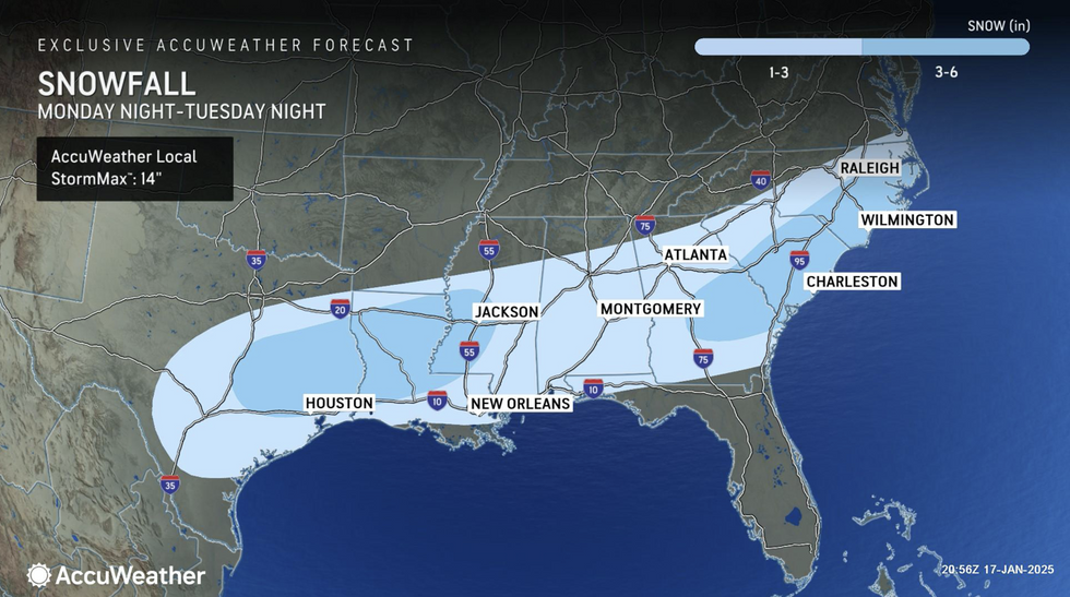
“We are closely monitoring a winter storm that could bring significant snow and ice to Gulf Coast states early in the week.
“Heavier snowfall totals in the three- to six-inch range could occur in the mountains of eastern West Virginia, far western Maryland, southwestern Pennsylvania and from central Maryland into eastern Pennsylvania, northern New Jersey, south-eastern New York and a large swath of central and eastern New England.”
Winter chaos is forecast to reach as far south as Texas and the Gulf States as ‘heavy bands of snow’ plough the region.
The US National Weather Service (NOAA) has cold-weather alerts in force across much of the country.
US to see extreme cold until Tuesday
AccuWeather
More severe ‘extreme cold warnings’ have been issued in northern states where temperatures will plunge to minus 20C.
A NOAA spokesman said: “We expect impacts from a rare, significant winter storm across the South this week which will begin for Texas on Monday night.
“The combination of frigid air reaching the Gulf Coast and the development of a low-pressure system over the Gulf will lead to a significant winter storm across the Gulf Coast and the southeast.
“A corridor of potentially heavy snow is expected near and just south of the Interstate 20 corridor, with a wintry mix of snow, sleet, and freezing rain closer to the Interstate 10 corridor.”
People heading out are warned to check forecasts and take precautions for ‘major’ traffic and travel disruption, he added.
AccuWeather map shows deep freeze over US
AccuWeather
Extreme cold will be driven by the jet stream plunging south over the US dragging freezing air from Canada and the Arctic.
Where the cold meets milder conditions to the south, a battle between the two will drive relentless storms.
Jim Dale, US meteorologist for British Weather Services and co-author of ‘Surviving Extreme Weather’, said: “This is the result of a dislocation of the Polar Vortex which has dropped over the US behind the jet stream.
“This week will bring heavy snow to parts of the country and probably the lowest temperatures of the winter so far.
“Where cold and milder air meet to the south there will be the risk of storms.”

 By GB News (World News) | Created at 2025-01-20 11:36:14 | Updated at 2025-01-20 14:42:45
3 hours ago
