 By GB News (World News) | Created at 2025-03-31 10:14:25 | Updated at 2025-04-02 01:42:17
1 day ago
By GB News (World News) | Created at 2025-03-31 10:14:25 | Updated at 2025-04-02 01:42:17
1 day ago
A ‘multi-day severe’ weather event has America on red-flag panic stations with a tornado-charged superstorm poised to smash the country.
National Weather forecasters have raised the alarm for torrential rain, destructive winds, and churning twisters loaded with giant hailstones.
A freak inland storm will build through the coming days, tearing a path through communities of around 180 million Americans.
AccuWeather meteorologist Bernie Rayno said: “Around 180 million people are at risk of impacts from severe weather through Monday as a complex storm takes shape in the central United States and advances toward the East Coast.
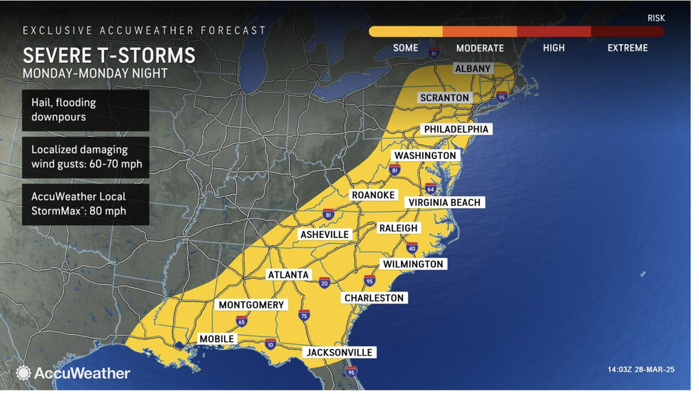
Millions of Americans at risk of ‘multi-day severe’ storm with 80mph winds and hail
AccuWeather
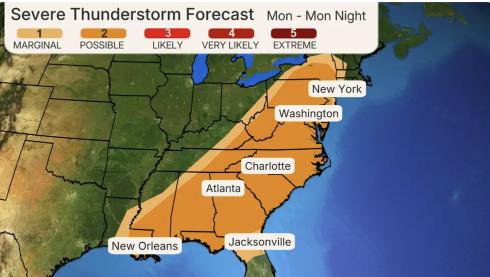
The Weather Company map shows thunderstorm forecast
The Weather Company
The frontal boundary between clashing air masses will fuel the building storm, experts warn.
Air coming off the Rockies will clash with tropical gusts from the Gulf of Mexico to light a powder keg.
Jim Dale, US meteorologist for British Weather Services and co-author of ‘Surviving Extreme Weather’, said: “This is a very big, severe storm system and is being driven by volatile atmospheric conditions fed by contrasting temperatures across the United States.
“At the moment we have a north-south split, with very cold temperatures to the north and very warm temperatures coming up from the Gulf of Mexico.
“Where these meet along the frontal boundary is going to be where the storm is most intense, and this is going to be a major risk through the week.”
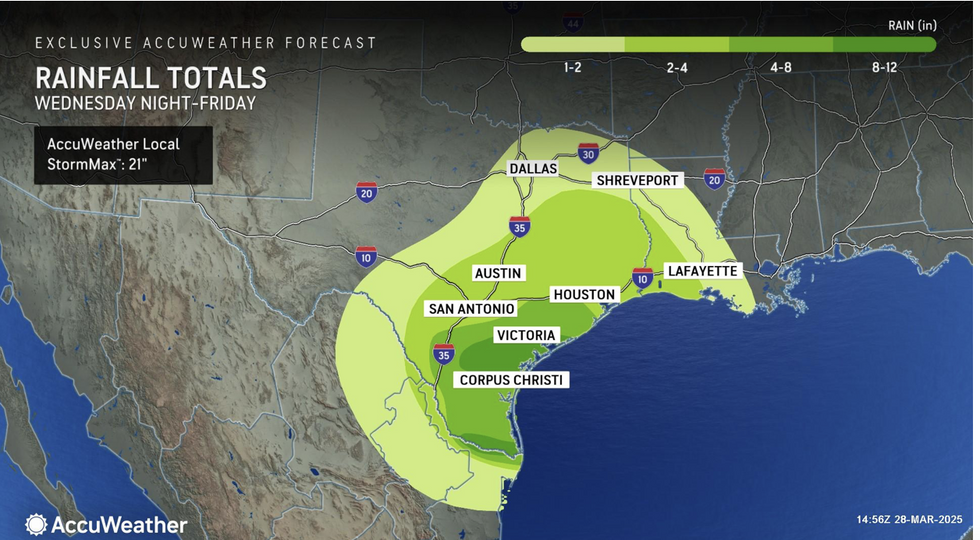
High levels of rainfall will occur in Texas
AccuWeather
The National Weather Service has an alert in force across central and eastern regions for severe weather into the start of the week.
A spokesman said: “Deep Gulf moisture … will bring a more significant threat of
severe weather, with the Storm Prediction Centre issuing a broad Enhanced Risk for
very large hail, destructive winds, and tornadoes, some of which could be strong.
“In addition, locally heavy downpours may also lead to some scattered instances of flash flooding.”
Central regions could be in the firing line of particularly large ‘supercell’ thunderstorms spawning deadly tornadoes.
Weather Company meteorologist Chris Dolce said: “The multiday severe weather threat will develop in the Midwest and South and then spread toward the East Coast by Monday.
“A strong low-pressure system with embedded strong wind shear will sweep from Kansas to New York, helping pull a moisture surge northward from the Gulf.
“These will lead as potential drivers of severe weather, including supercells.”