 By GB News (World News) | Created at 2025-03-17 13:56:08 | Updated at 2025-03-18 04:06:36
14 hours ago
By GB News (World News) | Created at 2025-03-17 13:56:08 | Updated at 2025-03-18 04:06:36
14 hours ago
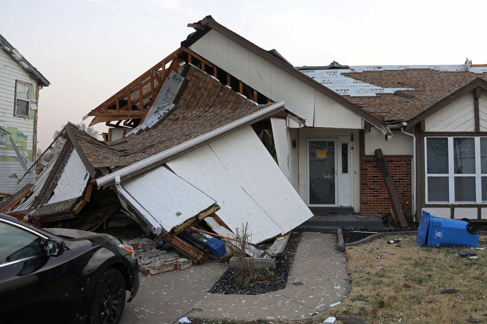
America faces another tornado-thunder assault after killer cyclones left more than 30 dead in a weekend of chaos.
A massive clean-up across six states will be hampered by another storm whipping up to smash the Midwest.
Though not likely to be as severe, the next storm fired up by raging jet stream winds will heap more misery on devastated communities.
Jim Dale, US meteorologist for British Weather Services, said: “There is another storm system building for around mid-week, and although this is not expected to be quite as potent as the one from the weekend, it does threaten more strong winds, thunderstorms and the risk of the odd tornado.
REUTERS
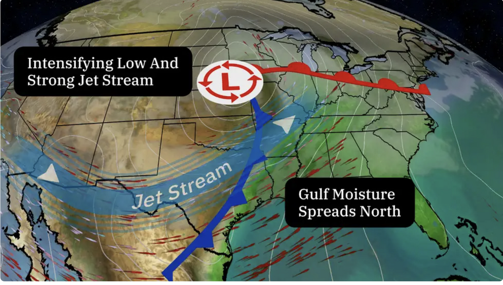
Jet stream fires up with clash of air masses
THE WEATHER CHANNEL
“Rain will continue over parts of the Northeast into the northern Mid-Atlantic with a narrow band of light snow from parts of the Lower Great Lakes to the Central Appalachians.
“There will be a slight risk of severe thunderstorms over the parts of the Lower Great Lakes, Central Appalachians, Mid-Atlantic, and the Southeast.”
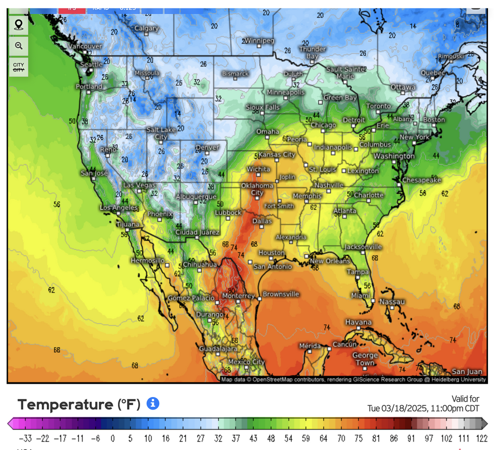
Severe weather across the United States is being fuelled by battling Arctic and tropical airmasses.
Unusually hot temperatures are surging from the Gulf of Mexico into the stubborn Arctic remnants of winter.
Where the two meet, the jet stream is unusually powerful, whipping low pressure systems into devastating storms.
Dale said: “The jet stream is going to bend around the Midwest, and it is particularly strong where we have this interaction between cold air to the north and tropical air coming in from the Gulf of Mexico.
Hot and cold collide
WEATHER.US
“There are some very high temperatures coming out of the south through this week, and it is this concentration of heat and moisture coming against the last ashes of winter which is driving these storms.”
The storm focus will shift through the Midwest to northern Florida and New York state, experts warn.
People travelling on the roads and transport networks are warned to prepare for ongoing disruption.
A cold front moving through will snuff the power out of the assault, with a smaller risk of thunderstorms through Monday.
AccuWeather meteorologist Sosnowski said: “The severe weather threat will come to an end as a strong cold front associated with the storm pushes off the Atlantic coast later Sunday night to early Monday.
“Some heavy, gusty thunderstorms may still occur on the tail end of the front in South Florida and the Keys on Monday.”