Hurricane-force storms raging into April as temperatures rocket will spark a fresh threat of monster ‘haboob’ dust clouds.
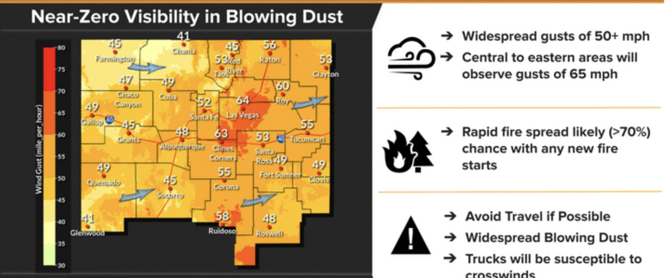
Roasting, bone-dry gales whipping up plumes of desert sand have prompted warnings for low visibility and travel disruption.
Dust clouds, also known as ‘haboobs’, threaten southern states while the rest of the US braces for torrential rain, thunder and hail.
Temperatures rocketing into the 90Fs in parts will bring the added risk of wildfires, experts warn.
Torrential rain and thunderstorms to the east will bring the risk of flooding as rivers reach bursting point
ACCUWEATHER
Explosive weather conditions will peak mid-week with more than two dozen tornadoes forecast in prone regions
ACCUWEATHER
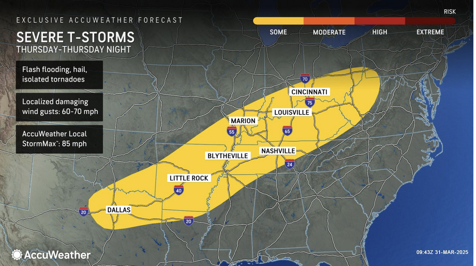
“There is a risk of hail, isolated tornadoes, flooding downpours and damaging wind gusts, with the greatest risk spanning from the Florida Panhandle to Virginia.”
AccuWeather severe weather expert Guy Pearson added: “Towns recently hit hard by tornadoes and severe thunderstorms could unfortunately be impacted again this week.
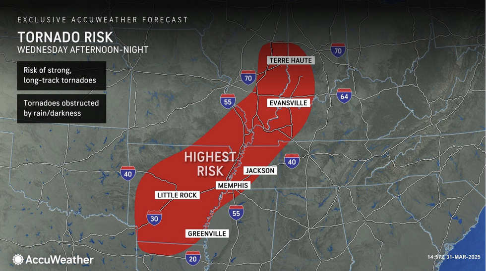
“The surge of warmth and moisture from the Gulf will be pulled farther north on Wednesday, supporting the risk of severe thunderstorms that could spin up tornadoes, produce large hail and damaging wind gusts.”
Explosive weather conditions will peak mid-week with more than two dozen tornadoes forecast in prone regions.
Heavy ‘soaking rain’ to the east will trigger rising river levels and ‘significant’ flash flooding.
AccuWeather meteorologist Bernie Rayno said: ““We are concerned about the increasing risk of significant flash flooding with potentially life-threatening impacts from the Ozarks to western Kentucky and the Ohio Valley.
Dust clouds, also known as ‘haboobs’, threaten southern states while the rest of the US braces for torrential rain, thunder and hail
NOAA
“More than a foot of rainfall is expected in some areas, which can quickly trigger life-threatening flash flooding that requires dangerous swift-water rescues.”
AccuWeather’s Brandon Buckingham added: “There is the risk of multiple strong tornadoes to form near the Texas-Arkansas border to perhaps as far north as portions of southern Illinois and central Indiana beginning Wednesday afternoon and continuing into Wednesday night.”
Severe weather will trigger multiple hazards through the rest of the week and into the weekend.
Volatile weather will be supercharged by tropical temperatures from the south surging into the residual winter cold.
Jim Dale, US meteorologist for British Weather Services and co-author of ‘Surviving Extreme Weather’, said: “There is a north-south split in terms of temperatures, and this is going to fuel the storms that will continue through the rest of the week.
“Along the frontal boundary, there will be an ongoing risk of thunderstorms, torrential rain and hail through the week.”

 By GB News (World News) | Created at 2025-04-02 11:09:37 | Updated at 2025-04-04 02:50:08
1 day ago


